Seahouses and North Sunderland : our informative website.
HOME page
Routes
Street plan
Attractions
Visit
Photo album
Walks to/from Sands Dunes Rocks Tidal Zonation Community Directory Trades Directory |
WHERE WE ARE
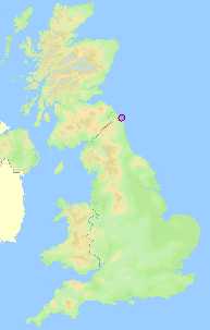
Seahouses is within the northern half of England's northernmost county, Northumberland. We are further north than Scotland's Selkirk, Ayr, Prestwick, and Mull of Kintyre, as well as every part of Northern Ireland.
|
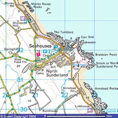
The local map shows that Seahouses plus North Sunderland make a single village, modest in size, with farmland to the west and south, sandy shores and dunes to the east interrupted by the rocks that form the harbour.
|
Maps reproduced from Ordnance Survey map data by permission of Ordnance Survey. |
SOME LINKS THAT YOU MAY FIND USEFUL Northumberland tourist information and services Seahouses Tourist Information Centre email: phone 01665 720884. Northumberland Coast Area of Outstanding Natural Beauty Berwickshire and North Northumberland Coast European Marine Site. Northumberland County Council As well as Ordnance Survey mentioned above, you can use Google Maps or other online services. ` |
|